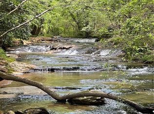
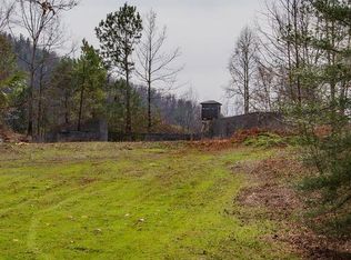
265.3 +/- acres joining the East Prong of the Lower Little River and Robinette Road in Alexander County, NC. Property is located on the southern flank of the Brushy Mountains, an isolated spur of the Blue Ridge Mountains. The trees on the property are predominately yellow poplar and mixed hardwoods, but white pine and Virginia pine are found on the southern end. There is ATV access into the interior of the property, but little vehicle access. This property is in Forestry Present Use Tax program. Zoning is RA-20 The property is south facing with a central ridge running north/south. There is some fairly level land on the southern end of the property with steeper slopes as you go further north into the property. The highest elevation on the property is at the top of Davis Mountain at 1940 feet. Elevations: Low 1160 High 1940 New survey by Fox Survey Company.
This property is off market, which means it's not currently listed for sale or rent on Zillow. This may be different from what's available on other websites or public sources.