This 45-acre parcel in Topsham offers a versatile opportunity for various commercial and residential uses. Here's a summary of its key features:
Size and Zoning: Approximately 45 acres total, with 35 +- acres zoned RCU (Rural Commercial Use) and 10 acres +- zoned R3 (Residential).
Road Frontage: 276 feet along Route 196, featuring an approved MDOT commercial entrance with a 75-foot paved section and a 200-foot base.
Permitted Uses:
Commercial: Options include Solar Energy Arrays, Marijuana cultivation/manufacturing/testing/caregiver stores, Professional Offices, Restaurants, Gas Stations, Day Cares, Neighborhood Grocery Stores, Medical Clinics, and Veterinary Hospitals, all subject to Planning Board approval.
Conditional Uses: See Land Use Table
Residential: Single-family, two-family, multifamily - in accordance with Note #6, Topsham Land Use Table.
The site was previously permitted with Topsham Planning Board for a 10-acre solar array.
This parcel presents a promising opportunity for a range of uses, benefiting from its substantial road frontage and flexible zoning options
Closed
$500,000
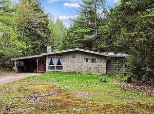
571 Lewiston Road, Topsham, ME 04086
--beds
--baths
47.24Acres
Land
Built in ----
47.24 Acres Lot
$-- Zestimate®
$--/sqft
$2,489 Estimated rent
Home value
Not available
Estimated sales range
Not available
$2,489/mo
Zestimate® history
Loading...
Owner options
List your home for rent
$2,489/mo
Rent Zestimate®
Find your next renter with Zillow Rental Manager. Plus, with online applications, you can quickly screen prospective tenants – for free.
Learn more$2,489/mo
Rent Zestimate®
Refinance and save
$3,163/mo
Est. payment
Refinancing to a lower rate could help reduce your monthly payments and save thousands over the life of the loan.
See today's rates$3,163/mo
Est. payment
Explore your selling options
Work with a Zillow partner agent
Leverage their expertise and Zillow's premium Showcase listings to get your home seen by more buyers.
Get startedList with your own agent
Get your home in front of millions of buyers by listing it on Zillow.
Learn how to do itSell it yourself
Take full control of how buyers see your home on Zillow by listing For Sale by Owner (FSBO).
List your homeWhat's special
Zillow last checked: 7 hours ago
Listing updated: June 20, 2025 at 07:13am
Listed by:
RE/MAX Riverside 2074498685
Bought with:
RE/MAX Riverside
RE/MAX Riverside
Source: Maine Listings,MLS#: 1602600
Facts & features
Property
Parking
- Parking features: Paved, On Site
Lot
- Size: 47.24 Acres
- Features: Near Shopping, Near Turnpike/Interstate, Rural, Level, Rolling Slope, Wooded
Details
- Parcel number: TOPMMR02L084
- Zoning: Rural Commercial Use
Utilities & green energy
- Electric: No Electric
- Sewer: None
- Water: None
Community & neighborhood
Location
- Region: Topsham
Other
Other facts
- Road surface type: Paved
Price history
| Date | Event | Price |
|---|---|---|
| 6/20/2025 | Pending sale | $599,000+19.8% |
Source: | ||
| 6/18/2025 | Sold | $500,000-16.5% |
Source: | ||
| 5/9/2025 | Contingent | $599,000 |
Source: | ||
| 3/5/2025 | Price change | $599,000-14.4% |
Source: | ||
| 9/4/2024 | Listed for sale | $700,000+42.9% |
Source: | ||
Public tax history
| Year | Property taxes | Tax assessment |
|---|---|---|
| 2024 | $3,006 -6.6% | $240,500 +1.5% |
| 2023 | $3,218 +19% | $237,000 +26.3% |
| 2022 | $2,705 -7% | $187,600 +2.3% |
Find assessor info on the county website
Neighborhood: 04086
Nearby schools
GreatSchools rating
- 9/10Woodside Elementary SchoolGrades: K-5Distance: 2.8 mi
- 6/10Mt Ararat Middle SchoolGrades: 6-8Distance: 2.4 mi
- 4/10Mt Ararat High SchoolGrades: 9-12Distance: 2.7 mi
- Maine
- Sagadahoc County
- Topsham
- 04086
- 571 Lewiston Road