This Townhouse style single family home offers 3 bedrooms and 1 bathroom with approximately 1280 square feet of living space on a 0.05 acre lot. There are no inspection or financing contingencies on this cash only purchase. No Buyer Premium on this property. The buyer has the right to select their own title/closing company. The buyer is responsible for all closing costs in this transaction. Seller will pay up to $1,000 in closing costs.
Auction

Est. $169,300
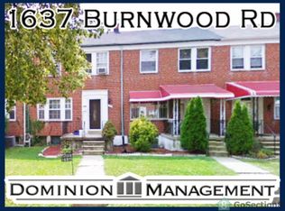
1641 Burnwood Rd, Baltimore, MD 21239
3beds
1,280sqft
Townhouse
Built in 1954
2,178 Square Feet Lot
$249,600 Zestimate®
$132/sqft
$-- HOA
Overview
- 7 days |
- 89 |
- 4 |
Zillow last checked: 17 hours ago
Source: Xome
Facts & features
Interior
Bedrooms & bathrooms
- Bedrooms: 3
- Bathrooms: 1
- Full bathrooms: 1
Features
- Has basement: No
Interior area
- Total structure area: 1,280
- Total interior livable area: 1,280 sqft
Property
Features
- Stories: 2
Lot
- Size: 2,178 Square Feet
Details
- Parcel number: 27095267O580
- Special conditions: Auction
Construction
Type & style
- Home type: Townhouse
- Property subtype: Townhouse
Condition
- Year built: 1954
Community & HOA
Location
- Region: Baltimore
Financial & listing details
- Price per square foot: $132/sqft
- Tax assessed value: $200,933
- Date on market: 4/1/2026
- Lease term: Contact For Details
This listing is brought to you by Xome
View Auction DetailsEstimated market value
$249,600
$235,000 - $262,000
$2,472/mo
Public tax history
Public tax history
| Year | Property taxes | Tax assessment |
|---|---|---|
| 2025 | -- | $200,933 +8.2% |
| 2024 | $4,383 +8.4% | $185,700 +8.4% |
| 2023 | $4,042 +9.2% | $171,267 -7.8% |
| 2022 | $3,701 +10.1% | $185,700 +30.4% |
| 2021 | $3,361 +1.6% | $142,400 +1.6% |
| 2020 | $3,306 +1.7% | $140,100 -1.6% |
| 2019 | $3,252 +1.7% | $142,400 +5.1% |
| 2018 | $3,198 +0.8% | $135,500 +0.8% |
| 2017 | $3,172 +36.1% | $134,400 +0.8% |
| 2016 | $2,330 | $133,300 +0.8% |
| 2015 | $2,330 | $132,200 |
| 2014 | $2,330 | $132,200 |
| 2013 | -- | $132,200 -11.8% |
| 2012 | -- | $149,900 +1.5% |
| 2011 | -- | $147,630 +1.6% |
| 2010 | -- | $145,360 +1.6% |
| 2009 | -- | $143,090 +17.4% |
| 2008 | -- | $121,932 +21% |
| 2007 | -- | $100,776 +26.6% |
| 2006 | -- | $79,620 +2.1% |
| 2005 | -- | $77,970 +2.2% |
| 2004 | -- | $76,320 +2.2% |
| 2003 | -- | $74,670 +1.1% |
| 2002 | -- | $73,870 +1.1% |
| 2001 | -- | $73,070 |
Find assessor info on the county website
Climate risks
Neighborhood: Perring Loch
Nearby schools
GreatSchools rating
- 5/10Northwood Elementary SchoolGrades: PK-5,7-8Distance: 0.2 mi
- 1/10Reginald F. Lewis High SchoolGrades: 9-12Distance: 1.1 mi
- NABaltimore I.T. AcademyGrades: 6-8Distance: 0.9 mi
- Maryland
- Baltimore City
- Baltimore
- 21239
- Perring Loch
- 1641 Burnwood Rd
Nearby cities
Nearby neighborhoods
Nearby zip codes
Other Baltimore Topics
