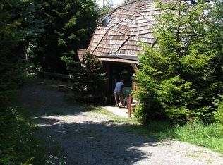
HIGHLIGHTS 255.5 surveyed acres Recent timber inventory estimates nearly 1/2 million board feet of harvest-ready timber Adjoins large farm and timber tracks Historic barn, machine sheds, outbuildings Currently operating as a cow/calf grazing operation for the months of April-November 107+/- open (hay and pasture) with some perimeter fence and cross fence 148+/- acres of mature hardwood and white pine forest Excellent access with 1/3 mile frontage on low traffic, 4-season state maintained Rt. 8 Dark skies with little or night pollution for star and planet gazing Wildlife is abundant with several fur bearing species represented Winged wildlife includes eagles, hawks, owls, ravens, and Neotropical songbirds Short drive to Snowshoe Ski Resort, Greenbank Telescope and Cass Railroad Varied topography with 10+ seasonal streams interspersed with flats and hillside Elevations run from 2765’ to 3150’ Fantastic flats on top that provides private cabin sites Land legacy of careful wildlife management coupled with outstanding long-term forest stewardship Nice network of interior trails provide access to nearly every corner Nearby is the Greenbrier River and River Trail – perfect for anglers and water recreation enthusiasts Spectacular long range views approaching 20 miles A good percentage of commercially – operable ground supporting farming, forestry, recreation and potential for numerous future cabin sites Electric on the property and phone nearby Low taxes, low population density, little or no light pollution LOCATION Sheets Road, Green Bank, WV Google Coordinates: 38.395866°(N), -79.844306°(W) Elevation Range: 2765 ft. to 3150 ft. +/- PROPERTY TYPE/USE SUMMARY The property is currently devoted to pasture and forestland use. A breakdown, as determined from aerial photography is as follows: Farm buildings and fields: 107 acres +/- Forestland: 148.5 acres +/- (balance of the property) (This summary is only an estimation of current property use as determined from aerial photography. It is made subject to the estimation of property boundaries and any errors in the interpretation of land use type from the aerial photography utilized.) DEED AND TAXES Deed Information: Deed Book 313 Page 511, Pocahontas County, West Virginia Total Survey Acreage: 255.5 acres +/- Real Estate Tax ID/Acreage/Taxes: Pocahontas County (38), West Virginia Green Bank District (4) TM 75 Parcel 19.1; HD HENCHES RUN 140.82 AC; Class 2; 2016 Real Estate Taxes: $98.56 TM 75 Parcel 20; HD HENCHES RUN 120 AC; Class 2; 2016 Real Estate Taxes: $199.96 2016 Total Real Estate Taxes: $298.52 SEE FOXFIRENATION.COM FOR MORE INFORMATION
This property is off market, which means it's not currently listed for sale or rent on Zillow. This may be different from what's available on other websites or public sources.