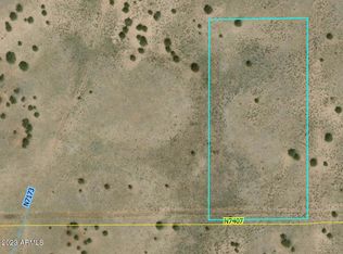
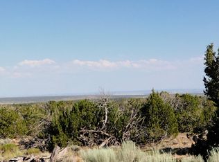
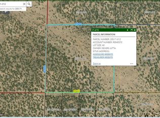
Please Contact The Owner Directly. Contact details are below the agent information. RV Okay, 10.02 Acres in Apache County, AZ! Welcome to Arizona! Settle now in this 10.02-Acre lot located in Apache County, AZ! This lot is situated in Co Rd 6350, St Johns, and is only a 12-minute drive to Arizona 61, a paved road on the east side of the property. 10.02 ACRE LOT NEXT TO THIS ONE IS ALSO FOR SALE! SKU: N/A Categories: Arizona, For Sale Description Welcome to Arizona! Settle now in this 10.02-Acre lot located in Apache County, AZ! This lot is situated in near St Johns, and is only a 12-minute drive to Arizona 61, a paved road on the east side of the property. 10.03 ACRE LOT NEXT TO THIS ONE IS ALSO FOR SALE! Going the town of St John is only 1 hour and 38 minutes from the property. The Town of Friendly Neighbors” is an appropriate descriptive motto for this community that takes pride in its close knit, family first attitude, high quality school system, and a city government that cares deeply about its residents and guests. There is also a library, restaurants and a lot to visit in the area. This property is likewise close to Sanders. When you travel northwest of the property, you’ll reach the gorgeous Petrified Forest National Park. Imagine a large basin area with numerous rivers and streams flowing through Type: Vacant Land Location: St Johns, AZ Country: United States State: ArizonaCounty: Apache ZIP: 85936 GPS Center Coordinates: 34.853585, -109.419201 GPS Corner Coordinates:; 34.8545234320376,-109.41841553371; 34.8545337693303,-109.418420247478; 34.8540438033233,-109.420181585175; 34.8519688404215,-109.420224013275; 34.853115392895,-109.417773548018; 34.8545234320376,-109.41841553371 Power: Alternative Sewer: Septic or alternative system Taxes: $114.6/ Annually Closing/Doc. Fees: $0.00 POA: $154 Provides community well and road maintenance Title: Clear Parcel Number: 205-79-131C Contract: Cash Sale Size: 10.02 acres Legal Description: Lot:131 Range: 28E Township: 17N Section:19 Legal Description 1:TRACT: Z SECTION: 19 TOWNSHIP: 17N RANGE: 28E (P-131C) COM NE COR OF LOT 131 RED SKY RANCH PHASE 2; SWLY 1141.07' TO POB SELY 544.81' SWLY 872.05' NLY 746.18' NELY 580.57' TO POB; IN SEC 19 T17N R28E. Subdivision Name: RED SKY RANCH PH General Elevation: 6,236 Ft. Zoning: Agricultural Water: would be by well or alternative Roads: Dirt/Gravel Time Limit to Build: Unlimited
This property is off market, which means it's not currently listed for sale or rent on Zillow. This may be different from what's available on other websites or public sources.